UN
8 Mowleaze
£ 210,000
Description
We don't have a Description for this property.
- Bedrooms
- 3
- Bathrooms
- 0
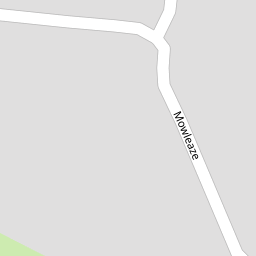
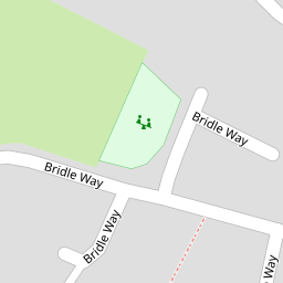

Leaflet © OpenStreetMap contributors
The heatmap indicates the level of crime in the area. The color of the heatmap indicates the crime severity and recency.
Metrics Year-on-Year
- Average area value
- 436,619.00 £Increased by 12.60 %
- Average area rental value
- 1,370.00 £/moIncreased by 52.39 %
- Est rental Yield
- 3.77 %Increased by 35.61 %
- Crime Rate
- 179.00 %Unchanged by 0.00 %
from 387,750.00 £
from 899.00 £/mo
from 2.78 %
from 179.00 %
Nearby Schools
| Name | Type | Ofsted | Distance |
|---|---|---|---|
| Barwick And Stoford Community Primary School | Community School | Good | 0.18 KM |
| Coker Building | Children's Centre Linked Site | 0.24 KM | |
| Reckleford Infant School And Nursery | Community School | Good | 2.72 KM |
| South Somerset Partnership School | Pupil Referral Unit | Good | 2.72 KM |
| Yeovil | Children's Centre | 2.79 KM |
Images
Nearby Streets
| Name | Average Price | Average Sqft | Distance |
|---|---|---|---|
| Church Lane | £ 650,000 | 0 | 0.00 KM |
| Dorchester Road | £ 240,000 | 0 | 0.00 KM |
| Aldon House | £ 600,000 | 0 | 0.00 KM |
Nearby Transport
| Name | NLC | TLC | Distance |
|---|---|---|---|
| Yeovil Junction | 5838 | YVJ | 1.54 KM |
| Yeovil Pen Mill | 5856 | YVP | 3.11 KM |
| Thornford | 5849 | THO | 5.20 KM |
| Yetminster | 5857 | YET | 6.25 KM |
| Chetnole | 5840 | CNO | 8.23 KM |
Nearby Listings
| Address | Price | Type | Score | Distance |
|---|---|---|---|---|
| Bridle Way, Barwick, Somerset, BA22 | £ 180,000 | BUY | Unknown | 0.13 KM |
| Bridle Way, Barwick, Yeovil, Somerset, BA22 | £ 230,000 | BUY | Unknown | 0.14 KM |
| 18 HIGHER BULLEN, BARWICK, YEOVIL | £ 150,000 | BUY | 5 / 10 | 0.33 KM |
| Church Lane, Barwick, Somerset, BA22 | £ 650,000 | BUY | 7 / 10 | 0.52 KM |
| New Road, Stoford, Yeovil, Somerset, BA22 | £ 370,000 | BUY | 7 / 10 | 0.59 KM |
Nearby Properties
| Address | Price | Distance |
|---|---|---|
| 24 Mowleaze | £ 150,000 | 0.00 KM |
| 30 Mowleaze | £ 135,000 | 0.00 KM |
| 8 Mowleaze | £ 210,000 | 0.00 KM |
| 30 Fairhouse Road | £ 180,000 | 0.13 KM |
| 4 Fairhouse Road | £ 150,000 | 0.13 KM |